by stratomaps
Calculate the shortest route for drones, UAVs, eVTOLs operating Beyond Visual Line Of Sight (BVLOS), while taking into account natural, artificial, and regulatory restrictions and prohibitions.
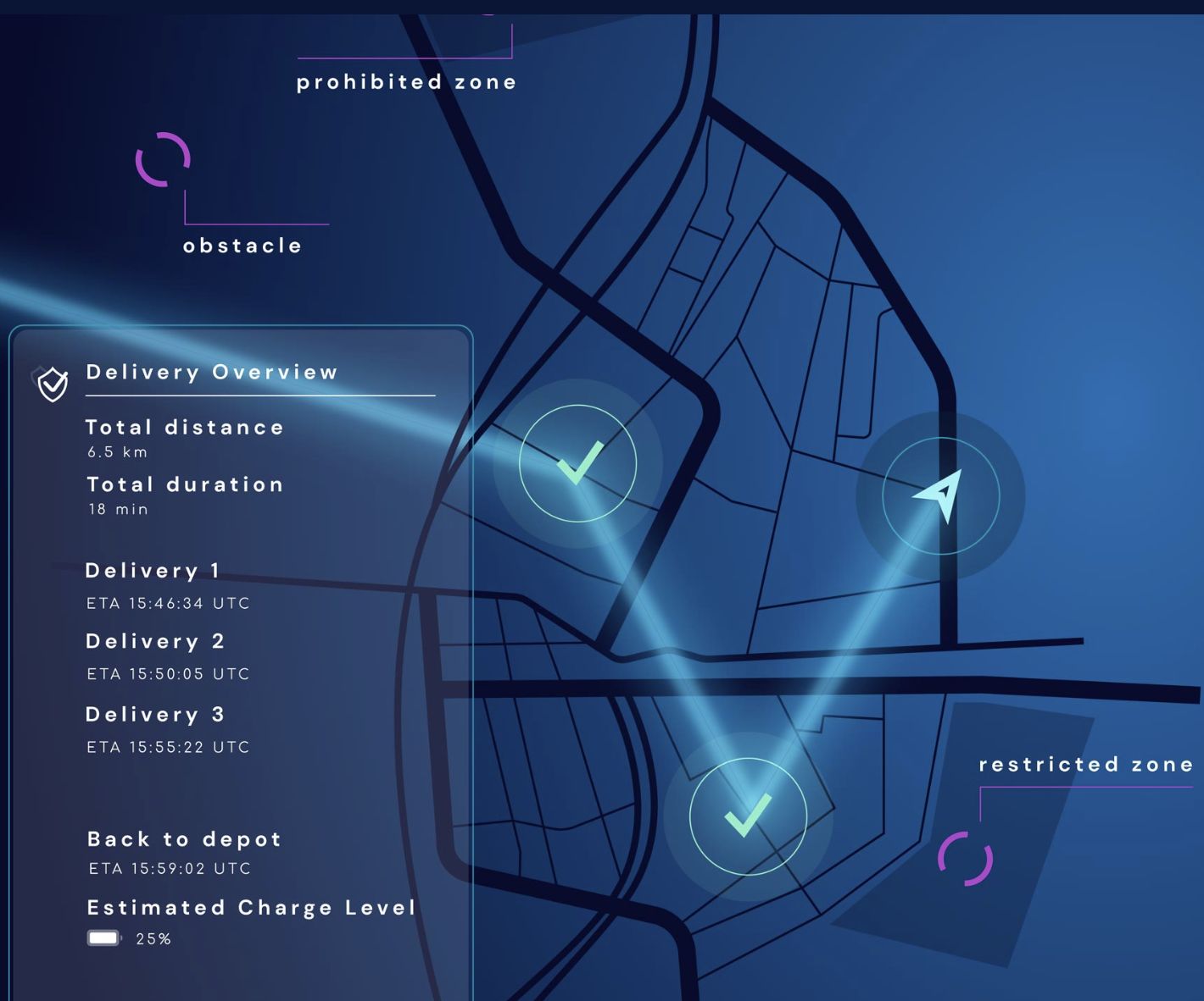
Calculate the shortest route for drones, UAVs, eVTOLs operating Beyond Visual Line Of Sight (BVLOS), while taking into account natural, artificial, and regulatory restrictions and prohibitions. The pathfinder service can serve as a SORA (Specific Operations Risk Assessment) helper tool, as the routing algorithm considers flight geography, contingency volume, and ground risk buffer around populated areas, as well as building footprints.
The routing service is customized to specific customer operational zones and requires API integration with the customer's backend system and/or application. It is designed to cater to U-space Service Providers (USSPs), UTM Service Providers (USPs), drone application developers, drone manufacturers, and, more broadly, companies operating UAVs that require accurate maps and services.
The UAV route planning API endpoint accepts multiple parameters to perform the route exploration from origin to the destination: