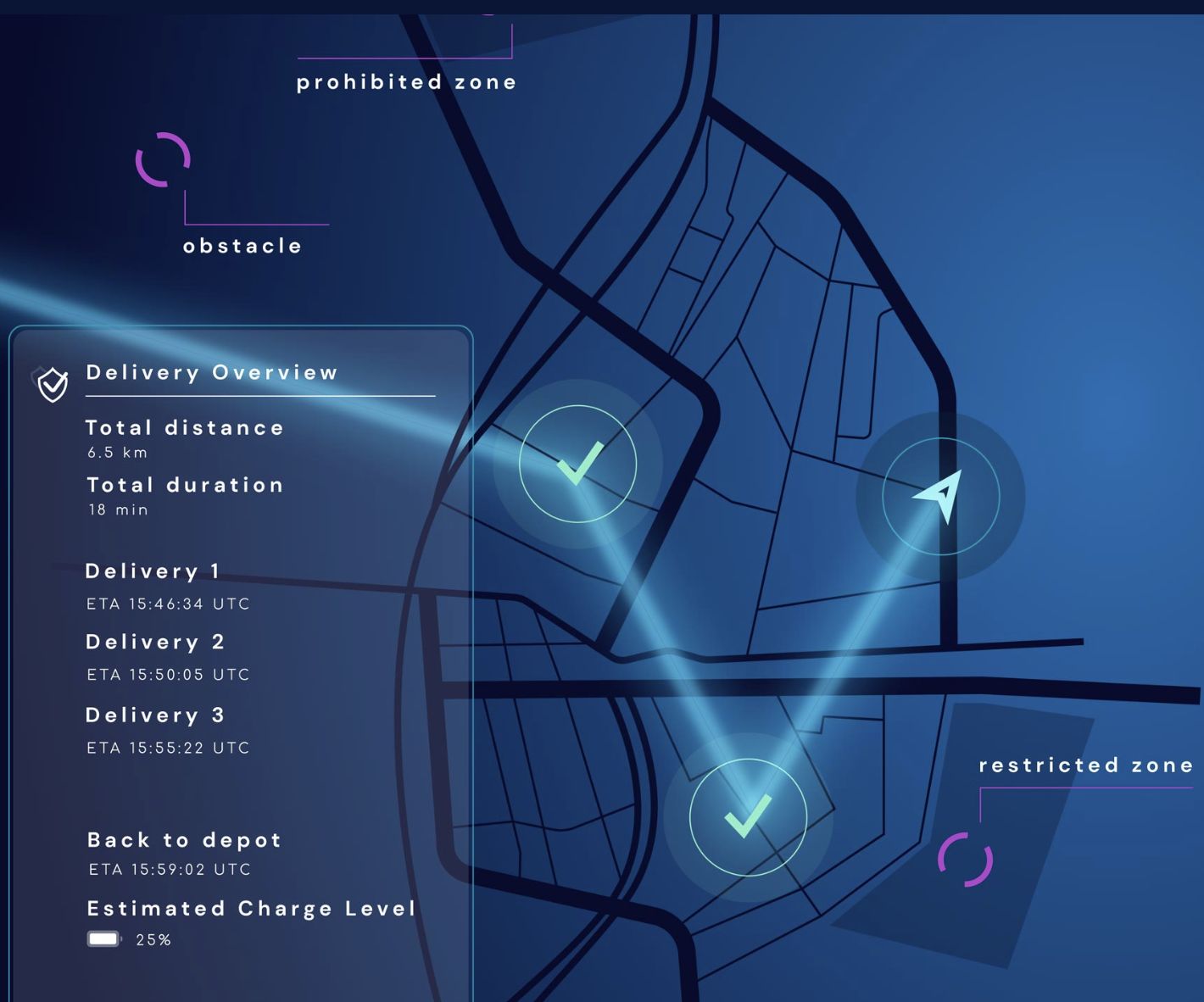
Stratomaps provides maps and geospatial services essential for unmanned aerial missions in security, rescue, surveillance and delivery. We excel at aggregating and processing precise ground and aerial data, tailored to specific mission areas. Our interactive 3D maps and API suite provide seamless integration with drone systems, ensuring safe, efficient and compliant flight operations.
Company Name:
Street:
ZIP
City:
Country:

Yvan Montalieau
Founder