
Aeva announce 4D sensors LiDAR integrated into intempora RTMaps
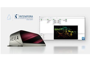
Intempora, a dSPACE company and specialist in advanced software solutions for autonomous driving, and Aeva, a specialist in sensing and perception systems, has announced that Aeva’s Aeries 4D LiDAR sensors, including Aeries II, have been integrated into Intempora’s RTMaps (Real-Time Multisensor applications) software platform. RTMaps allows engineers to accelerate the development and deployment of next generation automated driving solutions including Advanced Driver Assistance Systems (ADAS) and fully autonomous vehicles.
“Bringing Aeva’s next generation 4D LiDAR to the RTMaps platform is a significant step forward for developers working on the forefront of automated vehicle technology,” says James Reuther, vice president of technology at Aeva. “With this integration, they are now able to take advantage of Aeva’s unique capabilities and 4D data in the integration of ADAS and autonomous vehicle platforms.”
Aeva 4D LiDAR sensors use Frequency Modulated Continuous Wave (FMCW) technology to deliver unique sensing and perception capabilities not possible with legacy time-of-flight 3D LiDAR sensors to enable the next wave of driver assistance and autonomous vehicle capabilities, including:
- Instant velocity detection: Directly detect velocity for each point in addition to 3D position to perceive where things are and precisely how fast they are moving.
- Ultra long range performance: Detect and track dynamic objects such as oncoming vehicles and other moving objects at distances up to 500 meters.
- Ultra resolution: A real-time camera-level image providing up to 20 times the resolution of 3D LiDAR sensors.
- Semantic segmentation: Real-time segmentation enables the detection of roadway markings, drivable regions, vegetation, road barriers, as well as detecting road hazards like tire fragments at up to twice the distance of 3D LiDAR sensors.
- 4D localisation: Per-point velocity data enables real-time vehicle motion estimation with six degrees of freedom to enable accurate vehicle positioning and navigation without the need for additional sensors, like IMU or GPS.
“Aeva’s 4D LiDAR technology with instant velocity detection allows automated vehicles to detect and classify objects with higher confidence across longer ranges,” says Nicolas du Lac, CEO at Intempora. “We are pleased to enable Aeva on the RTMaps platform and provide our users and customers with access to the next generation of sensing and perception technology.”
RTMaps is a reliable middleware with a complete software stack to develop, test and deploy algorithms and advanced software functions for mobility. Trusted by OEMs and Tier 1 suppliers for over 20 years, RTMaps allows developers to easily develop, test, benchmark and validate multi-sensor applications for ADAS and autonomous vehicles. The software efficiently integrates and manages large amounts of data generated by different sensors such as cameras, radars, lidars, GNSS, and IMU, especially in the field of complex real-time systems like autonomous driving where large amounts of data are collected on the road.
Comment on this article below or via Twitter @IoTGN