

WiMi Hologram Cloud Inc., a global Hologram augmented reality technology provider, has announced that it is building a holographic digital twin cloud platform based on 3D point cloud technology to reconstruct the “people, objects and fields” of the physical world in the metaverse. Compared with traditional 3D models, 3D point cloud technology is not constrained by artificial modeling surface equations and surface continuity and can restore any complex 3D geometry with high precision and convenience, presenting finer details and sharper edges. (more…)
April 27, 2023
Posted by: Shriya Raban
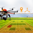
Business, government, and science organisations increasingly rely on drones, crewed aircraft, and satellites to capture imagery. Detailed imagery data provides visibility into operations and opportunities, unpacking information from every pixel and transforming static pictures into dynamic digital representations of the world. 3D models and high-resolution maps of construction sites, complex cityscapes, or entire countries allow these organisations to analyse and interact with a digital world that accurately shows places and situations as they are. (more…)
February 15, 2023
Posted by: Janmesh Chintankar

Lange, Germany. 3 June 2022 – Socionext Inc. introduced the “SC1240 Series” radio-wave ranging sensors that use the 60GHz band with a built-in signal processing circuit for detecting the position and movement of a person with maximum accuracy. Sample shipments are scheduled for Q2 2022, and mass production in Q1 2023. (more…)
June 3, 2022
Posted by: Shriya Raban
Innodisk, a global provider of industrial flash and memory solutions, announces its industrial-grade 112-Layer 3D TLC SSDs along with the capacity up to 8TB. (more…)
July 23, 2021
Posted by: Anasia D'mello

Velodyne Lidar, Inc. has launched its Intelligent Infrastructure Solution designed to solve some of the most challenging and pervasive infrastructure problems. This new solution combines Velodyne’s award-winning lidar sensors and Bluecity’s powerful Artificial Intelligence (AI) software to monitor traffic networks and public spaces. (more…)
May 11, 2021
Posted by: Anasia D'mello

Velodyne Lidar, Inc announced it has joined the Qualcomm Smart Cities Accelerator Program to promote using lidar technology in smart city solutions. (more…)
December 23, 2020
Posted by: Anasia D'mello

Through the 3D immersive online platform “Smart City Taiwan 360”, the Industrial Development Bureau (IDB) will showcase the solutions for smart cities developed by Taiwanese companies, as well as Taiwan’s leadership and technological capabilities via Smart City Taiwan 360 . (more…)
December 22, 2020
Posted by: Anasia D'mello

In many places across the US and globally, wearing a face mask is no longer an option, it is required when in public. As state governments make more strict mask mandates, it’s up to businesses to enforce them or face penalties and even potential shutdowns. Understanding the pressures many businesses face with enforcing face mask-wearing, SenSource is releasing its latest SafeSpace solution, an automated face mask detection system. (more…)
November 20, 2020
Posted by: Anasia D'mello
Trace Software International ha announced a cooperation between the photovoltaic design and simulation software archelios Pro and the mechanical software K2 Base, designed by K2 Systems. (more…)
September 28, 2020
Posted by: Anasia D'mello
Septentrio, a specialist in high-precision GNSS positioning solutions, has unveiled a new GNSS*/INS receiver, AsteRx-i D UAS. This multi-frequency receiver is said to combine reliable centimetre-level positioning with 3D orientation, enabling automated navigation of aerial drones and robots. (more…)
May 6, 2020
Posted by: Anasia D'mello